Saturday, February 11, 2017

Whole 30 Banana Pancakes

Whole 30 Banana Pancakes

Easy and tasty

Ingredients:

  • 2 bananas
  • 6 large eggs
  • 1/4 cup almond flour
  • 1-2 tbsp of oil (your choice)
  1. Add banana, eggs and almond flour to food processor and process until fluffy
  2. heat oil in pan
  3. pour batter in pan to make ~3 inch pancakes
  4. flip when set and bubbles appear
Makes 10-12 3 inch pancakes 

Whole 30 Sweet Potato Banana Pancakes

Texture of traditional pancakes.

Ingredients:

  • 2 sweet potatos
  • 2 bananas
  • 6 large eggs
  • 1-2 tbsp of oil (your choice)
  1. Peel and dice sweet potatoes into cubes. Place in bowl and microwave for ~6 minutes (time varies by microwave)
  2. Add bananas, sweet potatoes and eggs to food processor or blender. Process until fluffy or frothy.
  3. heat oil in pan
  4. Pour batter into pan 
  5. Flip pancakes when set and bubble appear at the surface.
Makes 10-12 3 inch pancakes.

Thursday, June 9, 2016

Big Horn Basin: Medicine Lodge Archaeological Site and Red Gulch Dinosaur Track Site

Wyoming is a new outdoor playground for our family. Missing the big mountains and desert valleys of Nevada, we choose to travel through the Big Horn Mountains and explore Big Horn Basin. First stop was Medicine Lodge Archaeological  State Park located outside of Hyattville and north of Hwy 16. The park has numerous lush campgrounds along a creek. The main attraction is a cliff of petroglyphs and excavation site that uncovered artifacts from up to 12,000 years ago.

The timeline is here to give us a sense of scale when thinking back 12,000 years, each sign refers to a point in history.
Here is a view of some of the petroglyphs, people with round bodies.
These historic cabins are open and offer interpretation of wildlife, vegetation, ecosystems, archaeology and geology.
This short, shaded nature trail travels from the petroglyphs to the cabins,over the creek and ends at the outcrop below. The creek was swollen and moving rapidly.
After exploring the State park we headed off to find the dinosaur track site and found that it was located on an unpaved scenic route called Red Gulch Byway. This route is over 30 miles long and in decent condition for high clearance vehicles and many passenger cars. There were some spots that could be very muddy with recent precipitation. If taking this route, bring food, water, a detailed map, and anything you might need if you become stranded.
The route twisted and turned through spring wildflowers and past beautiful canyons. This photos shows the eastern edge of the Big Horn Mountains and a sharp fold in the carbonate rocks, Big Horn Dolomite and Madison Limestone.
The dinosaur track site is located at the end of the byway near Hwy 14. The site is nicely developed by the BLM with a vault toilet, shaded picnic area, interpretive signs and shaded viewing area.
The track site can be viewed from above or you can walk along the outcrop.
The shaded viewing area is a nice break from the sun.
Ripple marks and a track.
Multiple tracks walking away.
Multiple tracks and a tiny descendant.

Monday, March 21, 2016

Jewel Cave Hub Loop

Hub Loop

This was my second trip to Jewel cave in South Dakota my first being 3 years ago with a toddler and a baby. This time the trip ventured off the tour route and required actual caving (with help from an elevator). Our group consisted of members of the Paha Sapa Grotto and a trip leader (this person knows where to go). We met in the basement of the visitor center to ready our gear, talk about safety and call our surface contact. Jewel Cave has a large amount of manganese oxide (dark gray mineral) that covers the cave floor in many passages. This manganese gets all over your clothing and gear and care must be taken to prevent the spread of it. So we brought extra shoes to stash along the tour trail.

We boarded the elevator  and traveled down to the lower level of the cave. We followed the tour route for a very short distance over metal bridges and up and down stairs to a stair case. We stashed our shoes out of sight and crawled under the stairs into  a small passage. We began following a trail marked with blue flagging tape Which would take us to the Hub loop marked with orange tape. We kept a quick pace only stopping occasionally for a  water and photo break. Our trip leader and other group members had great stories and interpretations for each stop.

Manganese deposits on floor

rare speleothems whose origin is not determined

walking passage

Gypsum spiders

gypsum spiders

explorers checking out an old carbide dump on top of some breakdown

traveling across breakdown

These guys are getting a closeup of a vug lined with clear dogtooth spar

So you can find those spiders

Gypsum spiders

Breccia paleofill

Photo break to see some dogtooth calcite spar and paleofill
I have a light coating of manganese all over me.

Monday, February 29, 2016

Winter Hike Stockade Lake Custer State Park, SD

Stockade Lake
Stockade Lake is located  near the western entrance to the park on Hwy 16. Take a right following the Stockade lake signs and the lake is on your right. During winter you will experience less crowds in Custer State Park but there will still be people camping and hiking on the weekends. 
 There is a playground and picnic tables next to the lake.

The lake is still frozen and a probably  thick enough for ice fishing.
The Stockade Lake Trail has parking next to this sign. The trail is a short 1.5 mile loop that climbs up and then back down.  

 Traveling up was fun and not too tough. You encounter many wonderful rocks along the trail including large pieces of clear quartz, grey feldspars, muscovite mica and quartzite.

 There are many view points at the top of climbs. This is a view of the Needles area and Harney Peak in the distance.
The trail eventually reached the top and then you come back down through some aspen trees. The rocks change on the way down.

 Near the end of the trial outcrops of granite make fun climbing boulders.

 Here you leave the trail and follow the road back to the trail head.


Wednesday, February 17, 2016

History Sticks in Muddy Nevada Cave 2014

This was the second kids caving adventure for our group of three caver families. We chose an easily accessed cave with mostly horizontal passages. This cave has a section of very dry and dusty passages with many and sometimes historic inscriptions on the walls. Once you pass through a constriction the cave becomes very, very muddy. This mud is the sticky kind that doesn't really rinse away instead you must scrape it off everything. The cave was included in George Wheeler's 1872 expedition and contains historic inscriptions form their cave expedition.
http://www.davidrumsey.com/luna/servlet/detail/RUMSEY~8~1~32259~1151615:Cave-Valley,-Nevada-


 The entrance is at road level and looks like a mine portal. This is the local bat biologist taking notes about the Townsend big-eared bats.
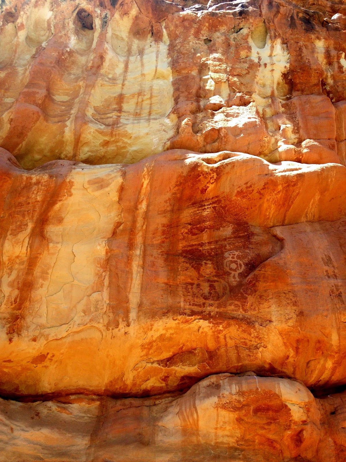
 The kids are clean and testing their cave lights. Note some of the many inscriptions on the rock behind them. Currently (2016) the Bureau of Land Management is inventorying and determining the historic and non-historic inscriptions in preparation for cleaning efforts.
 Kids 5, 8, 6, 4, 4, and 2.
 These guys are great at finding small passages.
 Carbide inscriptions.
 We finally left the dry part and ventured into the wet and muddy cave.
 We explored a side passage, crawling for adults yet walking for two-year-olds.
 We made it past the constriction and into the very sticky mud. This is one of the pits where the mud was mined and used for pottery. The kids stopped and began testing their climbing skills.
 Sometimes you need a hand from your friends. Half of our group, mainly adults and the oldest child, ventured further to collect data from data loggers. The small kids tried to follow but quickly became frustrated slipping, falling and getting stuck in the mud. The decided to stay at the pit and continue to slide in and then climb out.
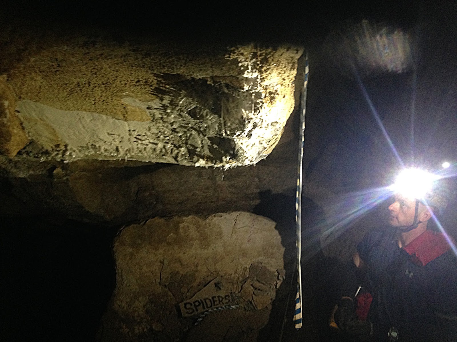
 These guys found something.
Then we moved back to the dry passages and the kids began to draw in the dusty floor.


 This little one couldn't stop climbing.
 We tested our ultraviolet light and looked for fluorescence in the rocks.
 These two tried telling scary stories.
 Our groups rejoined and these guys were muddy, though people often emerge covered from head to toe.
 Mostly free of mud with easier cleanup. I do have a helmet, I was just using it as light for the photo.